
Bloomfield Township Street Directory Address Trail
For a current street-by-street inquiry, anchor the work in the Bloomfield Township parcel rather than in a name alone. The township Assessor and Oakland County map tools use a situs address, PIN, legal description, subdivision and lot information to describe a place. That lets a searcher keep similarly named people, trusts, and mailing contacts from being blended into one result. An owner or taxpayer field is a recorded relationship to property, not a blanket statement about who occupies it.
- Search the address in the Bloomfield Township BS&A Assessing Search and save the parcel details, tax year, legal description, and any sale or building context shown.
- Open the same address or PIN in Oakland County Property Gateway, then use the map point to distinguish nearby parcels with similar street text.
- Use the parcel's legal description, PIN, or address in Super Index to identify recorded instruments and their dates.
- Check Michigan Voter Information Center only for its limited registration and election information, using the required name, birth-month, birth-year, and ZIP match fields.
- For an earlier household trail, consult a criss-cross or directory volume at the library and cite the edition date rather than treating the printed line as current.
This order moves from a physical parcel to a dated record trail. It also leaves room for a result that does not line up: a permit applicant, recorded party, voter, and historical directory entry can describe different relationships at different times.
Bloomfield Township Street Address Search Fields
The local and county portals do not use the same address syntax. BS&A is the most direct starting point for a Bloomfield Township street search because its global selector offers Address, Name, and Parcel Number, while its detailed address search can expose a street-address field and a street-number range. Property Gateway is particularly useful when a street name has a directional or only part of a number is known.
| Portal | Address controls | Useful output | Important limit |
|---|---|---|---|
| Bloomfield BS&A | Address, Name, Parcel Number; detailed Street Address and Street Number range | Land values, lot size, acreage, legal description, sales and building data | Reference material; select Bloomfield Township, Oakland County |
| Property Gateway | PIN or Property Address; map click; five-character minimum | Parcel location and fee-based reports or maps | Municipal update schedules differ |
| Gateway partial search | Examples include 1200 S, 123 S V, 1% Main, and 1% S% M | Directional or incomplete street leads | Confirm the returned parcel before drawing conclusions |
| Super Index | Search anything, advanced search, address, PIN, name, legal description, document number | Indexed recorded-instrument trail | Images and downloads use cart and payment controls |
The Oakland County Property Gateway search screen shows the single PIN-or-property-address approach and the county's examples for partial and wildcard queries.
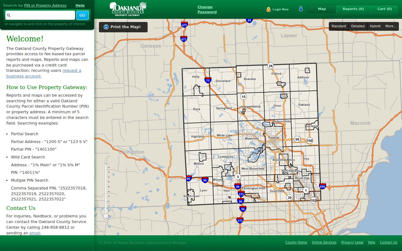
Use the returned property address and PIN as the common reference when comparing the map, assessor material, and land-record index.
Reading Bloomfield Township Parcel Fields
Parcel records have their own vocabulary. Read it before attaching a person to a street result, especially where a street has several lots, an association, or a changed postal label. The Assessor reports more than 18,000 real-property parcels, and its office remains the correction point for township parcel information.
- PIN
- A parcel identification number used to tie a mapped parcel to property and land-record searches.
- Situs address
- The physical property address used for assessment and mapping; it can differ from a tax or owner mailing address.
- Plat
- A recorded subdivision map. It helps connect a lot and legal description to a street but is not a household list.
- Criss-cross directory
- A historical directory arranged by street or telephone sequence, often used to find the printed household head for a particular edition.
Taxable status is determined on December 31 for the next tax year, so an assessment field and a later deed can legitimately differ. Keep the assessment year, recording date, and document role visible in notes instead of collapsing them into a single current claim.
Bloomfield Township Street Directory Records by Address
Address-keyed sources form a chain, but they are not interchangeable. The table below identifies what each source can contribute to a Bloomfield Township street search and how to use an alternative channel when an online result is thin or a paid image is needed.
| Address record | Custodian or tool | What it may show | Access route |
|---|---|---|---|
| Parcel and assessment record | Bloomfield Township Assessing / BS&A | PIN, situs, legal description, land, sales, and building data | Online, Assessor counter, phone, or a record request |
| Parcel map and report | Oakland Property Gateway | Map point, PIN, address, aerial and layer context | Online search or map click; reports and maps may be paid |
| Recorded instruments | Oakland County Register of Deeds / Super Index | Document number, recording date, indexed parties, legal description | Free guest index; paid image route; Pontiac office or records contact |
| Building activity | Township Building Division / BS&A | Dated permit and inspection activity tied to an address | Account-linked BS&A route, Building Division, or focused FOIA request |
| Historical assessment and maps | Township history sources and historical repositories | Older owner, parcel, road, value, and map context | Online finding aids, BTPL, historical society, library, or request |
Michigan voter records have a different role. MVIC can show limited registration and election information after an identity match, while Michigan protects security and identifying fields. A street address is therefore not a substitute for MVIC's name-based workflow or for a request to the proper election custodian.
Property Gateway also accepts multiple comma-separated PINs, which is useful only after each parcel has been separated by legal description and map position. Its cart and report controls can identify the PIN, property address, paper option, print scale, immediate print, PDF-only output, customer pickup, standard delivery, expedited delivery, preview, and cancellation choices. Those are report-order details, not evidence that a record image is free or that every municipal field was updated on the same day. The county directs corrections to the local community that supplied the data.
For a tax or payment question, Oakland Treasurer PayIt is a separate route. It accepts a street address or parcel number and lets users select current, delinquent, or personal-property tax, as a guest or through an account. Its published payment history applies to payments made on or after July 1, 2025. That timing and purpose make it a useful dated payment tool, but it does not replace the Assessor's parcel record or the Register of Deeds instrument trail.
Tracing Bloomfield Township Street Deeds
Super Index is Oakland County's principal land-record index for a street address trail. Its stated indexed coverage reaches back to January 1, 1964, except for the stated plat-map exception. Search by address, current or earlier owner, PIN, document number, or legal description, then compare the legal description across each result. Deeds, mortgages, liens, foreclosures, and releases can each name a party, but that party's role must stay attached to the instrument.
The Oakland County Super Index documents the free guest-search route, advanced search entry, sortable result rows, and the distinction between index data and paid document images.
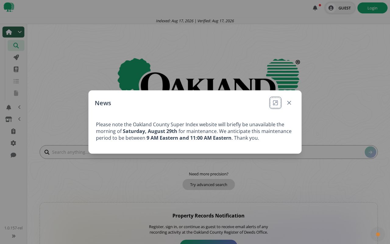
A document number, recorded date, legal description, and whether an image was actually reviewed make a deed-chain note reproducible.
For a pre-1964 gap, do not invent a digital deed result. Move to the historic assessment books, 1830 through 1947 ownership maps, library collections, older deed-book research, and in-person repository help. The county Register of Deeds is at 1200 N. Telegraph Road, Department 480, Pontiac, and lists 248-858-0597 and deeds@oakgov.com for its published contact route.
Bloomfield Township Street Building Activity
A permit can date work at an address without establishing a full household history. The township instructs users to sign in or register with BS&A, choose Bloomfield Township, Oakland County, select Services, and open View My Building Department Activity and Permits. The county qualifier matters because Michigan has another Bloomfield Township. Recent results may appear on the last page, and the online activity path is account-linked.
The Bloomfield Township Building Division instructions provide the municipality-selection and activity-search route.
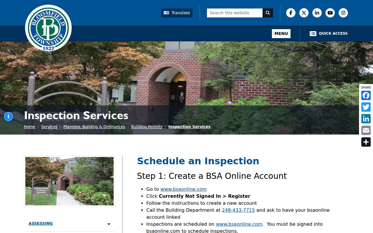
When the portal does not answer a dated question, ask the Building Division for the relevant permit or inspection record rather than treating the absence of an online result as proof that no record exists.
Applications may be filed in person or by mail to Township Hall, c/o Building Division, 4200 Telegraph Road. The township gives 248-433-7715 for inspection timing and says review is approximately ten business days. For a public-record request, state the address or PIN, record type, date range, and desired format in the township's NextRequest system so the custodian can apply exemptions and redactions.
Bloomfield Township Street Assessment Books, 1844–1976
Bloomfield's local record history reaches far beyond the digital parcel. The official township history identifies assessment books from 1844 through selected later runs, including typed, OCR-searchable material from 1934 through 1976. Earlier handwritten books need manual reading, so a missing text-search hit should lead to a page-image or repository check rather than a conclusion that a name was absent.
This deep-history trail works best when a current PIN or legal description is paired with a dated road reference. The 1976 tax-card example contains property address, parcel or PIN, owner, lot or subdivision description, values, acreage, building information, and paid status. It is an assessment snapshot, not a certified title record and not proof of a present relationship to the address.
Bloomfield Township Street Labels and Maps
Street research in Bloomfield Township crosses several geographies. The township surrounds the City of Bloomfield Hills, and historical sources may use Birmingham, Bloomfield Hills, Bloomfield Twp, or a road abbreviation for a location now tied to a township parcel. Preserve the printed locality in a historical directory or newspaper and compare it with the parcel and legal source rather than silently converting it.
Historical Society holdings identify ownership maps for 1830, 1857, 1872, 1896, 1908, 1916, 1920, 1927, 1937, and 1947, plus a 1915 Bird's Eye View. The township ZIP map also warns that boundary questions should be verified with recorded deeds, plats, tax maps, surveys, or other public records. A ZIP color or map label is useful context, not a legal boundary decision.
For printed household lines and street order, the library's historical collections are the appropriate next stop. The Bloomfield Township city directory guide explains the local directory runs and how to read their dated entries.
Boundaries of a Bloomfield Township Street Search
A street search can connect public, address-keyed records; it cannot create a complete current household list. Property records distinguish owner, taxpayer, parcel, and mailing or situs information. Permit records may identify an applicant or contractor for a dated activity. Court and voter systems have their own access rules, and utility, motor-vehicle, protected voter, sealed-court, and confidential vital information do not become public merely because an address is known.
Lawful personal use. Use Bloomfield Township street records for personal research, property history, family history, or civic questions. Do not use an address trail to stalk, harass, intimidate, or confront another person.
When a record cannot be found online, use the responsible channel: Assessor at 248-433-7710, Register of Deeds at 248-858-0597, the Building Division, the library or historical society for older material, or a focused Michigan Freedom of Information Act request. Michigan FOIA generally calls for a response within five business days, with a possible ten-business-day extension, but it does not override a record-specific confidentiality rule.